Ben Nevis Plateau
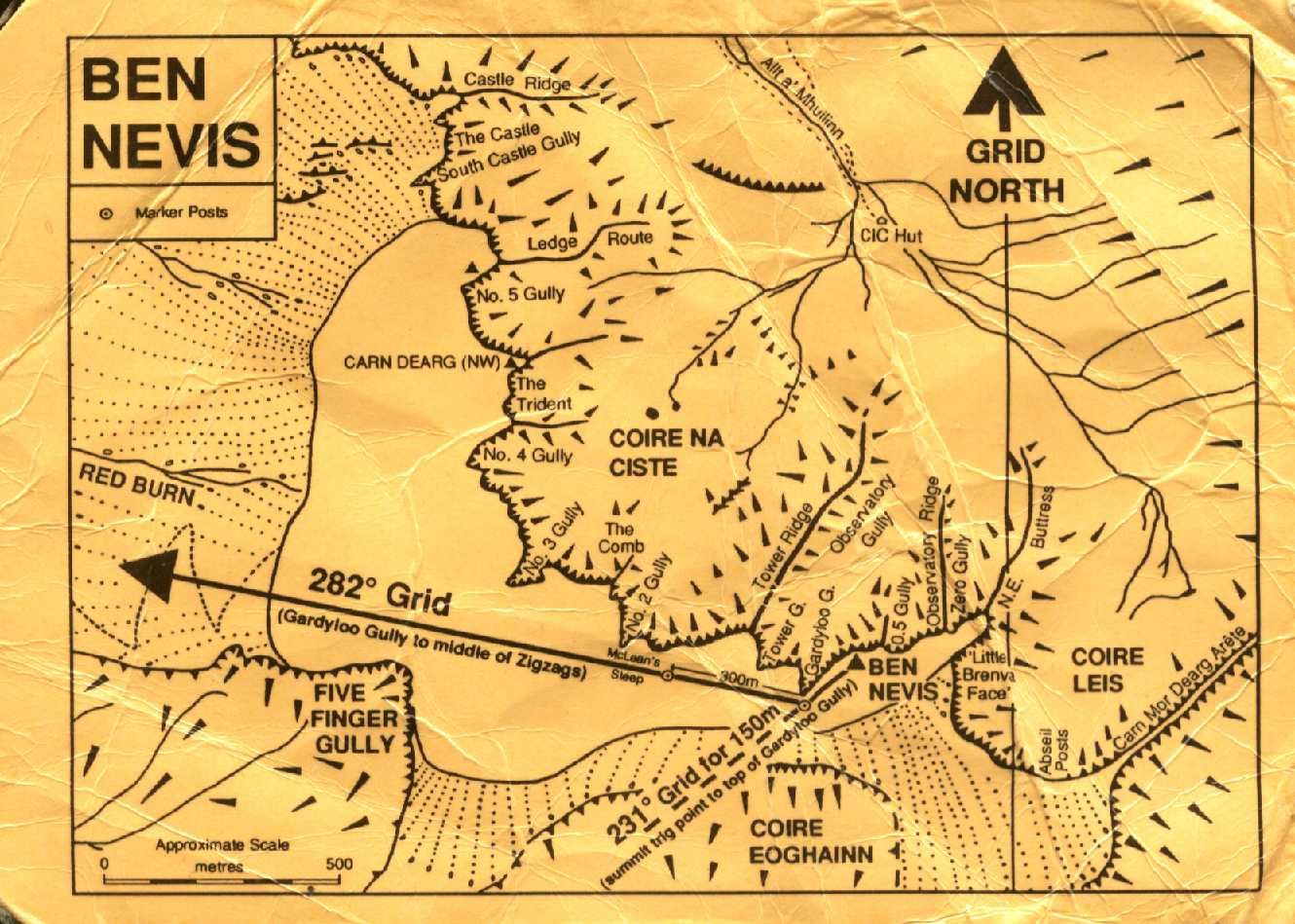
Descending from the Summit of Ben
Nevis
The following information is replicated:
Warning: these bearings and distances are only likely to be
of assistance if you are already a competent navigator. Even very
experienced mountaineers can have great difficulty navigating
accurately in severe wind or 'white-out' conditions, such as occur
frequently on the Ben Nevis plateau.
- From the summit trig pillar walk 150
metres on a GRID Bearing of 231° to near the top of
Gardyloo Gully (fist marker pole?).
- Then follow a GRID bearing of 282° to
clear the plateau. (A second marker pole is situated 300m along
this second bearing at the top of McLean's Steep).
Note: At present (1999) magnetic north lies
about 4.2° west of grid noth for Ben Nevis. In order to
calculate magnetic bearings (i.e. the value to set your compass to)
it is necessary to ADD 4° to the GRID bearings. This
adjustment will decrease by about 1° every 6 years.
This card was sponsored by Lochaber Tourist
Board and Lochaber Mountain Rescue Team.
Produced by LMRT, Police Station, Fort William,
Inverness-shire.